Introduction to geologic areas
The 3D model with defined subsoil and geologic profiles displays the subsoil surface. This surface defines the area where soil properties between boreholes is inter- and extra- polated.
Be to able to define a geologic fault, the basic surface polygon has been divided to the separated areas which are inter- and extra- polated but the first area doesn’t affect the next one.
Different number of layers in the geologic profile may be used in different areas. For example 5 layers in all boreholes in area 1 and 8 layers in all boreholes in area 2.
The line between two geologic areas is geologic fault.
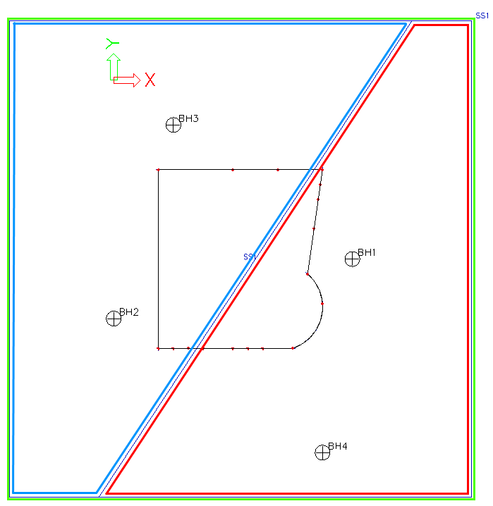
Green - basic outline of the subsoil surface
Red - Geologic area 1
Blue - Geologic area 2
Red-Blue line - Geologic fault