Introduction to boreholes
Boreholes together with geologic profiles provide the program with information relating to the composition of foundation soil. Both data are necessary to calculate the interaction between the structure and the soil below it.
A borehole is fully defined by the (i) corresponding geologic profile, (ii) location and (iii) altitude. Usually a set of boreholes will be defined and thus they can be used to calculate and display the surface of the land in their surrounding. This surface can be used for impressive presentations of your project. The surface itself is not taken into account during the calculation.
The following picture shows an example of defined boreholes. The rectangle represents the patch of land over which the soil properties can be inter- and extra- polated.

Next picture than shows the calculated surface.

Sand-gravel pile
There is a possibility to use the borehole as a sand-gravel pile. The sand-gravel pile consists from geologic profile and a geometry which defines its outline. The sand-gravel-pile outlines has the same behaviour as geologic fault.
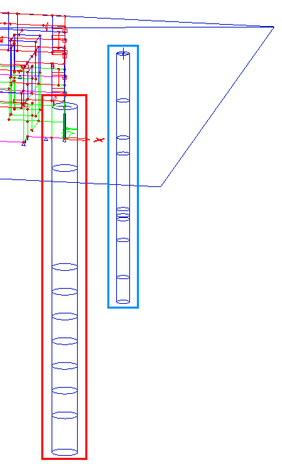
The red colour shows a sand-gravel-pile with diameter 1m.
The blue colour shows a standard borehole.
Both are displayed inside the subsoil surface outline.